
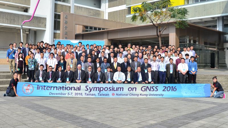
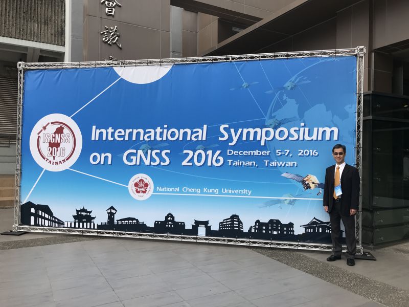
http://isgnss2016.geomatics.ncku.edu.tw/

1989~1995 |
美國俄亥俄州立大學碩士、博士 |
1983~1987 |
國立成功大學學士 |
Master Students
李祐丞

李依璇

游崴鈞
.png)
Ph.D. Students
許懷謙

2025/05/16-18韓國仁川


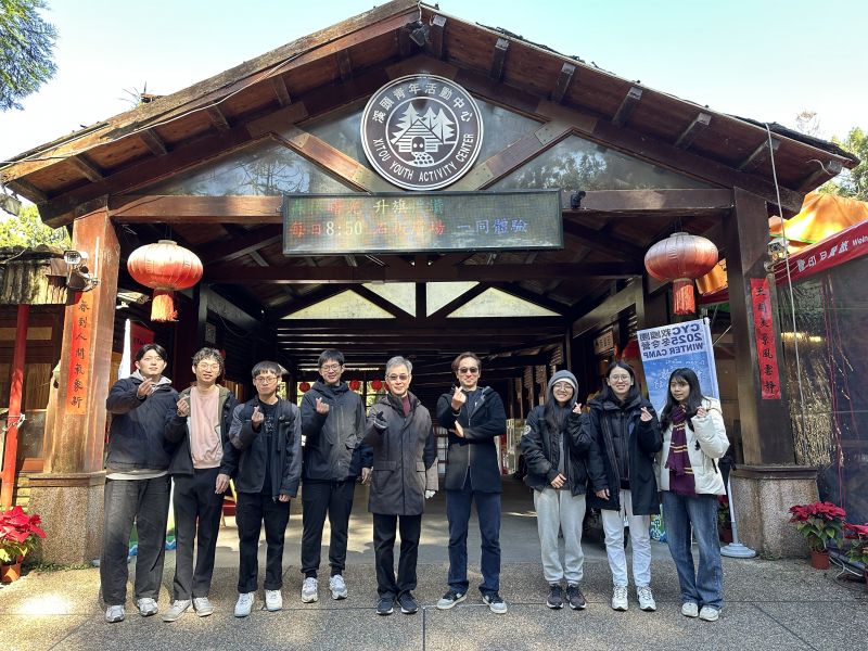
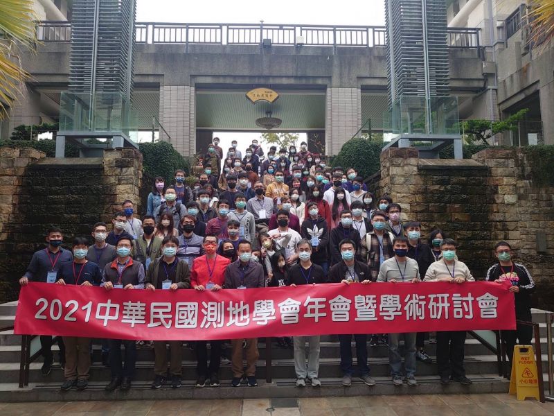
2025/01/15-17南投溪頭

2023/08/22-23台中谷關


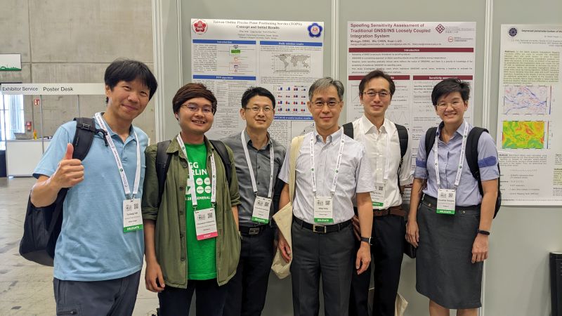
2023/07/12-14德國柏林

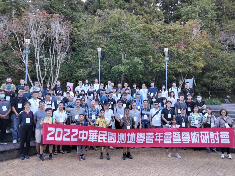
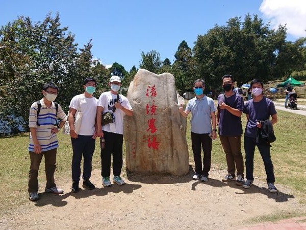
2022/08/23-25南投清境農場
2022/01/24-26台南尖山埤

2020/08/18-21南投杉林溪


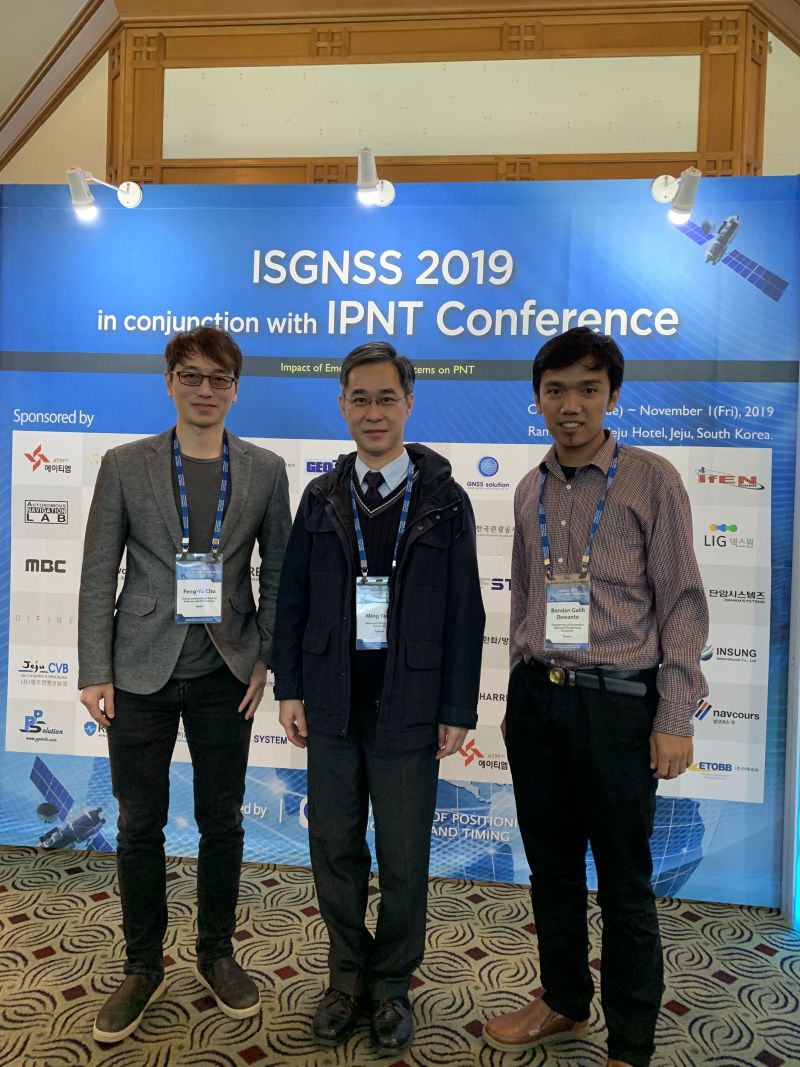
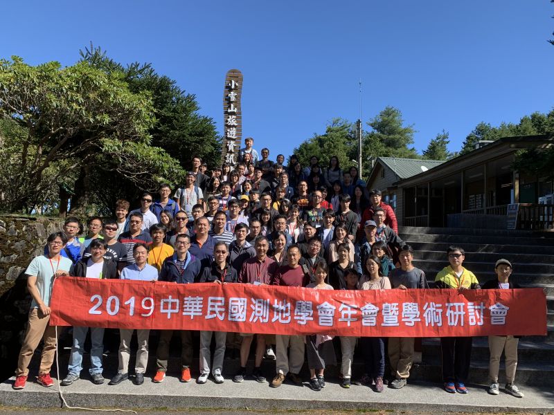
2019/10/29-11/1韓國濟州島

2019/08/26-28台中大雪山

2018/11/21-23印尼峇里島

2018/08/20-22宜蘭明池


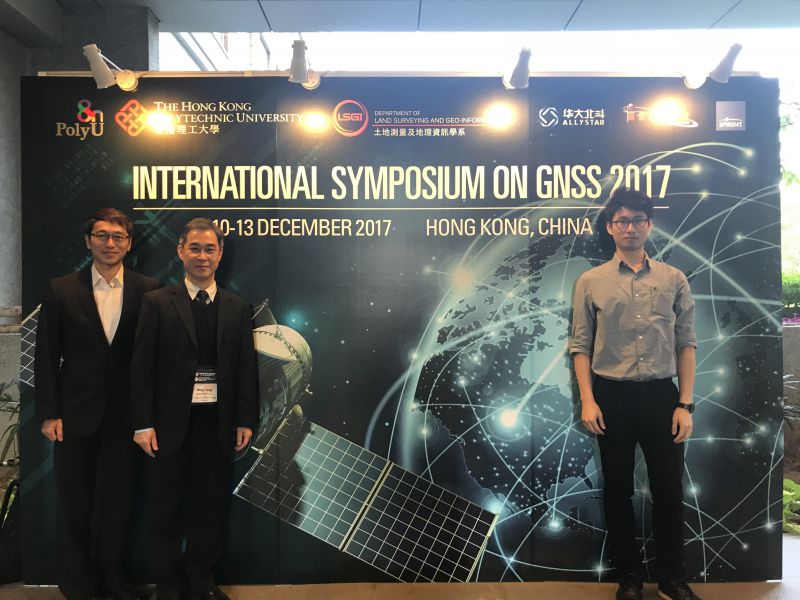
2017/12/10-13香港
2017/08/16-18南投溪頭


2017/05/17-19日本名古屋


2016/09/5-7合歡山、武陵農場


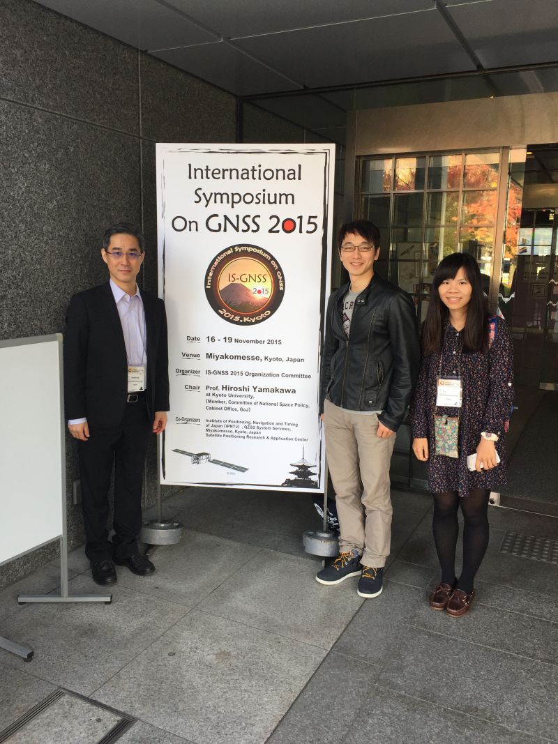
2015/11/16-19日本京都

2015/08/31-09/01南投惠蓀林場
2014/09/12嘉義阿里山


2013/09/11-13花蓮天祥


2012/09/06桃園拉拉山

2011/09/5-7宜蘭太平山


2009/11/4-6韓國濟州島


2009/04/04南投清境農場

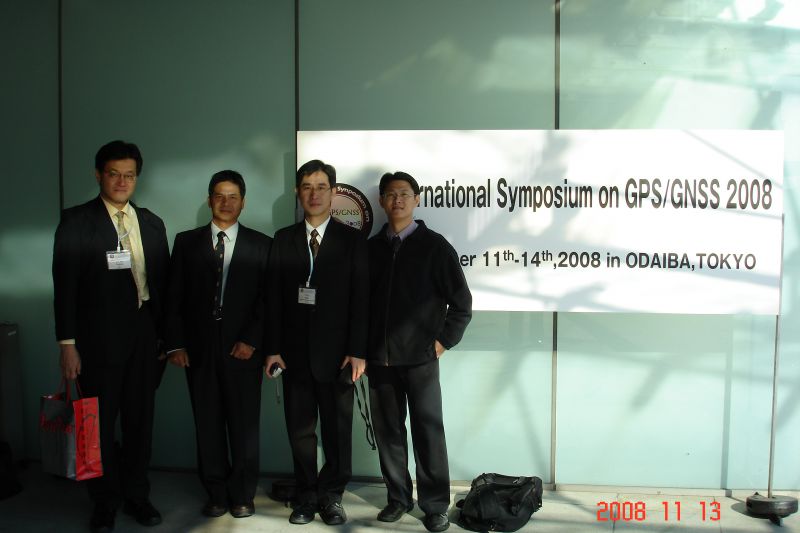
2008/11/11-14日本東京

| 研究生 | 論文名稱 | Thesis Title | 論文出版年 | 畢業學年度 | 博士生 | 共同指導 |
| 余彥琛 | 使用區域電離層模型提升精密單點定位效能:在太陽活動活躍期 | Using regional ionosphere maps to improve precise point positioning performance in high solar activities | 2024 | 113 | ||
| 林家齊 | 基於狀態空間表示之精密單點定位精度評估:PPP-RTK和SSR-post | Accuracy assessment of state space representation-based precise point positioning: PPP-RTK and SSR-post | 2024 | 112 | ||
| 林諦 | 台灣PPP-RTK服務測試成果 | Test Results of PPP-RTK Service in Taiwan | 2022 | 110 | ||
| 許懷謙 | 台灣線上精密單點定位服務(TOPS)之設計與建立 | Design and implementation of Taiwan online precise point positioning service (TOPS) | 2021 | 109 | ||
| 李皇緣 | 使用全球電離層模型提升GPS精密單點定位成果 | Using global ionospheric maps to improve the performance of GPS precise point positioning | 2021 | 109 | ||
| 李俊賢 | 估計台灣高鐵里程TK331段高架橋結構變位及評估其影響:使用GPS、水準、角邊測量技術 | The estimation of THSR viaduct structure displacement nearby mileage TK331 and evaluation of its impact: using GPS, leveling , angle and distance surveying techniques | 2020 | 108 | ||
| Bondan Galih Dewanto | 使用2007-2012年GPS連續站資料分析印尼西蘇門答臘2010年與2012年地震 | Using 2007-2012 Continuous GPS Data to Study the 2010 and 2012 Earthquakes in the Seismic Gap Area in Mentawai, West Sumatra, Indonesia | 2020 | 108 | ||
| 趙家賢 | 以2015至2018年大地測量資料分析車瓜林斷層地表變形及橫跨斷層之高架橋結構位移 | Geodetically observed surface deformation of Chegualin fault and structure displacement of an intersecting viaduct, 2015 to 2018 | 2019 | 107 | ||
| 王文喆 | 低價位雙頻GNSS接收器即時動態定位效能分析 | Performance assessment of RTK positioning with a multi-GNSS dula-frequency low-cost receiver | 2019 | 107 | ||
| 吳岱育 | 結合GPS及BDS對於定位效能之提升:應用於大地監測 | Combining GPS and BDS to improve positioning performance: application to geodetic monitoring | 2018 | 106 | ||
| 葉怡靖 | GPS/GLONASS/BeiDou整合式系統自主導航定位之方法與效能分析 | Integrated GPS/GLONASS/BeiDou autonomous positioning: method and performance analysis | 2017 | 105 | ||
| 洪怡貞 | 利用2002-2015年大地測量資料探討台灣西南部現今構造之運動特性 | Present-day kinematics of active structures in SW Taiwan using geodetic data from 2002-2015 | 2017 | 105 | 景國恩 | |
| 林玠妤 | 整合GPS、GLONASS和BeiDou於高精度動態定位之研究 | Integrated GPS/GLONASS/BeiDou high-precision kinematic positioning | 2016 | 104 | ||
| 陳彥廷 | 適用於高度電離層影響之單一時刻GNSS RTK定位演算法 | An algorithm for single-epoch GNSS RTK positioning under higher ionospheric influence | 2016 | 104 | ||
| 陳勇昇 | 藉由大地測量資料探討龍船斷層與旗山斷層之間震變形特性 | Interseismic deformation of the Longchuan and Chishan faults using geodetic measurements | 2015 | 103 | 景國恩 | |
| 江冠昱 | 使用一般化DCAR/TCAR演算法於GPS/BDS單一時刻週波值解算之研究 | GPS/BDS single-epoch ambiguity resolution using a generalized DCAR/TCAR algorithm | 2014 | 102 | ||
| 楊開元 | GPS/BDS衛星導航之方法與效能 | Method and Performance Analysis of GPS/BDS Integrated Satellite Navigation | 2014 | 102 | ||
| 郭徐伸 | 建立台灣半動態基準之水平速度模型 | Establishing a Horizontal Velocity Model for a Semi-dynamic Datum of Taiwan | 2014 | 102 | ||
| 張李群 | 以大地測量資料進行龍船斷層與旗山斷層行為分析之研究 | Behavior analysis of the LCNF-CHNF fault system using geodetic measurements | 2014 | 102 | ||
| 張詒翔 | 電子化全球衛星即時動態定位系統應用於車載移動製圖平台定位表現之研究 | A Feasibility Study of Using e-GPS for Mobile Mapping System | 2014 | 102 | ||
| 蘇文毅 | 網路RTK應用於GPS正高測量之精度分析-以恆春半島為例 | Accuracy analysis of GPS heighting with network RTK observations: a case study in Hengchun Peninsula | 2013 | 101 | ||
| 儲豐宥 | 三頻GPS/Galileo長距離相對定位:方法及效能分析 | Triple-Frequency GPS and Galileo Long-range Relative Positioning: Approaches and Performance Analyses | 2013 | 101 | 博士 | |
| 洪慶忠 | 以最小二乘配置法建立台灣地區水平速度場模型 | Establishing a Horizontal Velocity Model of Taiwan Using GPS Observations and the Least-squares Collocation Technique | 2012 | 100 | ||
| 陳志嘉 | 以精密單點定位技術估計GPS 追蹤站之絕對位移速度 | Absolute Site Velocity Estimation Using The GPS Precise Point Positioning Technique | 2011 | 99 | ||
| 孫翊騰 | 適用於電離層高活動期間之現代化GPS長基線計算方法 | A modernized GPS long baseline computation method for high ionospheric activity periods | 2010 | 98 | ||
| 吳曉雯 | 臺灣區域性對流層延遲模式之發展 | The Development of a Regional Tropospheric Correction Model over Taiwan | 2010 | 98 | ||
| 沈力洋 | GPS/Galileo單頻即時動態定位效能分析 | A Feasibility Study of GPS/Galileo Single-frequency RTKPositioning | 2010 | 98 | ||
| 黃玉婷 | 利用TWVD2001水準資料推估臺灣地區高程變動速度場之研究 | Estimation of Taiwan Vertical Velocity Field Using TWVD2001 Leveling Data | 2008 | 96 | ||
| 陳彥杕 | 應用水氣輻射天頂延遲觀測量於GPS相對定位之研究 | Application of Water Vapor Radiometer Zenith Delay Measurements in GPS Relative Positioning | 2008 | 96 | ||
| 彭德熙 | 台灣區域性電離層模型之估計:應用於單頻精密單點定位 | Estimation of Taiwan Regional Ionospheric Model:Application to Single Frequency Precise Point Positioning | 2008 | 96 | ||
| 張耀允 | GNSS單一時刻即時動態週波未定值解算:使用LAMBDA和CAR兩種方法 | GNSS Single Epoch Real-Time Kinematic Ambiguity Resolution : Using LAMBDA and CAR Methods | 2007 | 95 | ||
| 陳勇福 | 利用絕對重力測量與GPS觀測台灣衛星追蹤站高程變化之比較分析 | Comparisons of geocentric height changes derived from absolute gravimetry and GPS at continuous tracking stations in Taiwan | 2007 | 95 | ||
| 吳東軒 | 精密水準測量誤差分析:轉點沉陷效應之探討 | Analysis of Error Sources in First-order Leveling:Effect of Subsidence of Turning Point | 2006 | 94 | ||
| 張茂欽 | 提升空載GPS網形動態解算精度之研究 | Improving the accuracy of airborne GPS network kinematic positioning | 2006 | 94 | ||
| 李定諺 | 由GPS觀測量測定飛行載具速度及加速度應用於空載重力測量 | Determination of aircraft velocity and acceleration with GPS for airborne gravimetry | 2005 | 93 | ||
| 儲繼光 | 利用B樣條曲面表示及更新台灣大地水準面之研究 | Using B-Spline Surface to Represent and Update Taiwan Geoid Model | 2005 | 93 | ||
| 沈三齊 | ITRF2000下台灣追蹤站框架之建立與探討TWD97坐標系統之變化 | Construction of Taiwan GPS Tracking Network under ITRF2000 and Corresponding Transformation Parameters with TWD97 | 2005 | 93 | ||
| 馮倩君 | 以多參考站為基礎之GPS即時動態定位演算法發展 | An Algorithm for Network-Based Real-Time Kinematic GPS Positioning | 2004 | 92 | ||
| 陳國華 | 整合TWVD2001水準及GPS資料改進台灣區域性大地水準面模式以應用於GPS高程測量 | Improving Local Geoid Model of Taiwan Using TWVD2001 Leveling and GPS Data with Application to GPS Heighting | 2004 | 92 | 博士 | |
| 黃文祥 | REV-2000GPS單頻模組相對定位精度分析 | Accuracy analysis on relative positioning using single-frequency data from REV-2000 GPS modules | 2004 | 92 | ||
| 何家輝 | 以動態法計算CHAMP衛星短弧軌道 | CHAMP Satellite Short-arc Orbit Determination using Kinematic Method | 2003 | 91 | ||
| 蘇哲民 | TWVD2001一等水準觀測資料之系統誤差分析 | Systematic Error Analyses of TWVD2001 First-order Leveling Data | 2003 | 91 | ||
| 蕭翔文 | 以大地位數為基礎之TWVD2001高程計算 | Geopotential Number-based TWVD2001 Heights Computations | 2002 | 90 | ||
| 侯瓔瑞 | 以Colombo經驗模式表示低軌衛星軌道擾動之分析 | Representation of orbit perturbations of LEO satellites using the Colombo empirical model | 2001 | 89 | ||
| 高士杰 | 中華三號衛星計畫GPS掩星技術反演大氣溫度與壓力之模擬誤差分析 | A Simulated Error Analysis of Temperature and Pressure Retrieval Using the GPS Occultation Technique for the COSMIC Project | 2000 | 88 | ||
| 賴英豪 | 中華三號衛星GPS觀測量應用於提昇地球重力場球諧係數精度之模擬分析 | Gravity Field Improvement Using GPS Data from COSMIC:a Covariance Analysis | 2000 | 88 | ||
| 林書賢 | 應用IGS追蹤站提昇中華一號與二號衛星星曆精度之研究 | Improving the Accuracy of Orbit Ephemeris of the ROCSAT-1 & -2 Satellites Using the IGS Network | 2000 | 88 | ||
| 唐進賢 | 中距離(10-50公里)GPS即時動態定位演算法之研究 | An Algorithm for Medium Range(10-50km) Real-Time Kinematic GPS Positioning | 1999 | 87 | ||
| 劉佾博 | 近即時動態法中華三號衛星星曆之測定:使用MicroLab-1資料 | Near Real-Time Kinematic Satellite Ephemeris Determination for the ROCSAT-3 Satellites:Using MicroLab-1 Data | 1999 | 87 | ||
| 林世賢 | 應用分散式卡耳曼濾波於INS/KGPS動態定位之研究 | The Use of Decentralized Kalman filtering in INS/KGPS | 1998 | 86 | ||
| 陳俊廷 | 聯合水準、重力、GPS觀測資料之台灣地區高程系統精度預估 | Accuracy prediction of Taiwan Height System Realized by Integrating Leveling, Gravity and Gps Measurements | 1998 | 86 | 曾清涼 | |
| 洪志偉 | GPS衛星之雷射測距資料應用於大地絕對坐標之測定 | The Application of Laser Tracking to GPS Satellites for Geodetic Absolute Positioning | 1998 | 86 | 曾清涼 | |
| 張順隆 | 台灣地區基準轉換之研究 | A Study of the Geodetic Datum Transformation Problem in Taiwan | 1997 | 85 | ||
| 孫連水 | 即時動態GPS測量應用於控制測量與戶地測量之研究 | The Application of Real Time Kinematic GPS on Control Survey and Cadastral Survey | 1997 | 85 | ||
| 陳國華 | 應用多測站-多時段嚴密平差法進行台灣一等GPS大地網計算之研究 | Multistation-Multisession Adjustment of Taiwan First Order GPS Geodetic Network | 1997 | 85 | ||
| 蕭志書 | 快速強鈍即時性GPS動態測量系統之研究 | Rapid, Robust, Realtime GPS | 1996 | 84 | ||
| 吳錫賢 | 利用雙重天線與單頻資料進行即時性On-the-FlyGPS定位研究 | Real-Time On-the-Fly GPS Using Dual Antennas with Single- Frequency Data | 1996 | 84 |