首頁
|
NCKU
|
English
|
系統管理
|
系所影片
系所宣傳影片
系所招生影片
113學年度大學甄選
113申請入學第2階段面試公告(0329)
申請入學審查資料準備指引
大學甄選入學委員會
暑期工讀活動
公務部門
民營企業
系所介紹
系徽
簡史
近期發展方向
教學宗旨
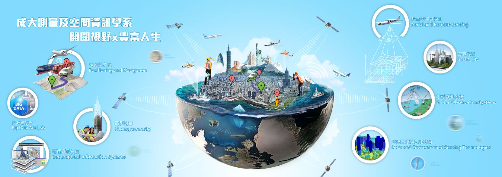
研究領域
就業市場
教育目標
核心能力
系館位置圖
樓層平面圖
系所介紹手冊
系所法規
系所成員
現任教師
行政人員
系所心理師
委員會組織
歷屆系主任
退休教師
教學資訊
修業規定
大學部
全校英外語課程
108學年度
109學年度
110學年度
111學年度
112學年度
研究所(碩士班)
研究所(博士班)
雙主修、輔系
大學部課程
研究所課程
課程地圖
講義及教材
總實習
數位學習平台 (Moodle)
課程大綱管理系統
學術研究
研究實驗室
航測及遙測實驗室
創新衛星定位實驗室
3G實驗室
整合式定位技術發展實驗室
空間資訊人工智慧實驗室
大地科學實驗室
環境遙測實驗室
數碼城市實驗室
智慧型地理資訊系統實驗室
遙測及空間資訊實驗室
地殼變形監測與分析實驗室
空間資訊分析與智慧管理實驗室
空間資訊探勘與應用實驗室
空間社會科學實驗室
空間資訊及環境健康實驗室
衛星軌道與PNT應用實驗室
研究領域
研究成果
歷屆碩士論文
歷屆博士論文
招生訊息
大學部
碩士班
博士班
表格下載
獎學金
國外進修獎學金
高中生專欄
專業培養
課外活動
學生組織
深造機會
就業市場
雇主單位
產業徵才
網路資源
IEET中華工程教育學會-認證學程查詢
相關系所
大地測量
遙感探測
地理資訊
G Suite教育版
空間借用
系友會
史天元會長給系友的信
捐款專區
捐款收支明細
捐款芳名錄
捐款單下載
劃撥單範本
測量系系友獎學金
系友會獎學金辦法
系友會入會申請表
理監事會議記錄
系友會章程(草案)
歷屆博士論文
2016/04/07